Charleswood Map

Charleswood Map

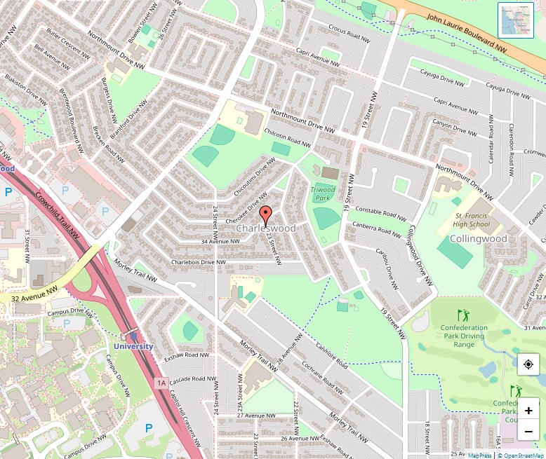
Charleswood is a picturesque residential neighbourhood situated in the northwest quadrant of Calgary, Alberta. Known for its proximity to natural parks and educational institutions, it has become a sought-after location for families and professionals alike. Geographic Location Nestled east of Crowchild Trail and adjacent to the University of Calgary, Charleswood enjoys a strategic location. It … Read more

Copperfield Map

Copperfield Map

Copperfield is a vibrant residential neighbourhood situated in the southeast quadrant of Calgary, Alberta. The community has experienced rapid growth and development since its inception, becoming a popular choice for families and individuals alike. Geographic Boundaries The neighbourhood is strategically bordered by 52nd St. to the west, Stoney Trail to the south, and the neighbourhood … Read more

Currie Barracks Map

Currie Barracks Map

Currie Barracks is a dynamic residential neighbourhood positioned in the southwest quadrant of Calgary, Alberta. The area holds a rich history, having once served as the Canadian Forces Base (CFB) Calgary. Today, it stands as a testament to thoughtful urban redevelopment and community building. Historical and Geographical Context The neighbourhood is strategically bordered by the … Read more

Garrison Green Map

Garrison Green Map

Garrison Green stands as a vibrant residential neighbourhood in Calgary’s southwest quadrant. Previously a part of the Canadian Forces Base (CFB) Calgary, this area has transformed into a bustling community, boasting a unique blend of history and modern living. Location and Background Situated between Richardson Road SW and Glenmore Trail, and bordered by Crowchild Trail … Read more

Chaparral Map

Chaparral Map

Chaparral stands out as a picturesque residential community in the southeast quadrant of Calgary, Alberta. Established in 1995, it is well-known for its 32-acre artificial lake, a 21-acre park with stunning waterfalls, and its strategic location at the southern edge of the city. This neighborhood is under the governance of Mayor Jyoti Gondek, represented in … Read more

Canyon Meadows Map

Canyon Meadows Map

Canyon Meadows is a vibrant residential neighborhood in the southwest quadrant of Calgary, Alberta, offering a mix of natural beauty and urban convenience. Overview Country: Canada Province: Alberta City: Calgary Quadrant: SW Ward: 13 Established: 1965 Elevation: 1,085 m (3,560 ft) Location and Amenities Canyon Meadows enjoys a prime location, bordered by Anderson Road to … Read more

Capitol Hill Map

Capitol Hill Map

Capitol Hill stands as a thriving residential neighborhood in the northwest quadrant of Calgary, Alberta, providing a blend of historical charm and modern amenities. Overview Country: Canada Province: Alberta City: Calgary Quadrant: NW Ward: 7 Established: 1948 Elevation: 1,090 m (3,580 ft) Population (2006): 4,044 Location and Environment Capitol Hill is strategically located north of … Read more

Castleridge Map

Castleridge Map

Castleridge is a vibrant residential neighbourhood situated in the northeast quadrant of Calgary, Alberta, offering a diverse and active community life. Overview Country: Canada Province: Alberta City: Calgary Quadrant: NE Ward: 5 Established: 1980 Annexed: 1961 Elevation: 1,090 m (3,580 ft) Population (2006): 6,180 Location and Environment Castleridge is strategically located east of the Calgary … Read more

Cedarbrae Map

Cedarbrae Map

Cedarbrae stands proudly in Calgary’s southwest quadrant, providing a tranquil yet vibrant living environment for its residents. Overview Country: Canada Province: Alberta City: Calgary Quadrant: SW Ward: 11 Established: 1973 Annexed: 1959 Elevation: 1,125 m (3,691 ft) Location and Environment Cedarbrae is bound by Southland Drive, 24 Street W, Anderson Road, and Tsuut’ina Trail, providing … Read more

Cambrian Heights Map

Cambrian Heights Map

Cambrian Heights stands as a suburban residential neighborhood in Calgary’s northwest quadrant, providing residents with a blend of natural beauty and urban convenience. Overview Country: Canada Province: Alberta City: Calgary Quadrant: NW Ward: 7 Established: 1957 Annexed: 1910 Elevation: 1,105 m (3,625 ft) Location and Environment Cambrian Heights enjoys a strategic location immediately southeast of … Read more