Taradale Map

Taradale Map, Calgary

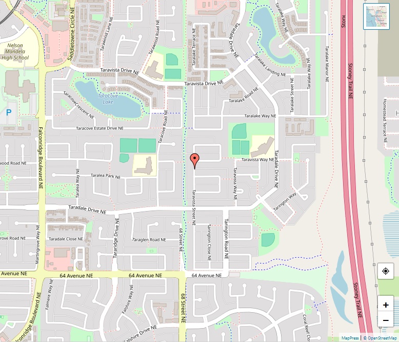
Taradale is a dynamic and diverse residential neighborhood located in the northeastern quadrant of Calgary, Alberta. Its establishment in the mid-1980s marked the beginning of a community that would grow to be a vibrant and integral part of Calgary’s suburban landscape. Geographical Layout Positioned with coordinates at 51°07′06″N 113°56′12″W, Taradale is defined by its boundaries … Read more

Sunnyside Map

Sunnyside Map, Calgary

Sunnyside is a vibrant and historic community located within the heart of Calgary, Alberta. It is nestled on the north side of the Bow River and offers a blend of residential calm and urban vitality, being immediately adjacent to Calgary’s downtown. Geography and Accessibility With coordinates at 51°03′10″N 114°05′09″W, Sunnyside is bounded by Centre Street, … Read more

Sundance Map

Sundance Map, Calgary

Sundance is a peaceful and attractive residential neighborhood located in the southeast quadrant of Calgary, Alberta, known for its eponymous lake and family-friendly atmosphere. Location and Geography Sundance is situated at coordinates 50°54′05″N 114°02′33″W. The community is to the east of Macleod Trail, bordered by Midnapore and Fish Creek Provincial Park to the north and … Read more

Sunalta Map

Sunalta Map, Calgary

Sunalta is a diverse and dynamic neighborhood in the southwest quadrant of Calgary, Alberta. Known for its close proximity to the downtown core and its eclectic mix of housing options, Sunalta presents an urban living experience with historic roots. Location and Boundaries Positioned at 51°02′33″N 114°05′58″W, Sunalta is conveniently located southwest of downtown Calgary. It … Read more

Strathcona Park Map

Strathcona Park Map, Calgary

Strathcona Park offers its residents a suburban retreat with the conveniences of city life. It’s a neighborhood characterized by its elevated position, spacious homes, and family-friendly atmosphere. Location and Boundaries Strathcona Park is situated at 51°02′50″N 114°10′23″W, offering a commanding view of the surrounding area due to its high elevation at 1,185 m (3,888 ft). … Read more

St. Andrews Heights Map

St. Andrews Heights Map, Calgary

St. Andrews Heights, a residential gem nestled in the northwest quadrant of Calgary, Alberta, combines accessibility, scenic views, and a tight-knit community vibe, creating a unique living experience for its residents. Location and Boundaries St. Andrews Heights is strategically located at 51°03′35″N 114°07′46″W, offering stunning vistas of downtown Calgary. The community is bounded by the … Read more

Spruce Cliff Map

Spruce Cliff Map, Calgary

Nestled in the southwest quadrant of Calgary, Alberta, Spruce Cliff stands as a vibrant residential neighbourhood, offering its residents a blend of natural beauty, accessibility, and a sense of community. Location and Boundaries Spruce Cliff occupies a prime location with coordinates at 51°03′02″N 114°08′22″W, offering stunning views and easy access to various city amenities. The … Read more

Springbank Hill Map

Springbank Hill Map, Calgary

Springbank Hill stands as a large and diverse suburb on the western city limits of Calgary, Alberta. Established in 1999, this community in the southwest quadrant of the city boasts a mix of residential options and amenities, creating a vibrant living space for its inhabitants. Location and Geography With coordinates at 51°01′50″N 114°11′37″W, Springbank Hill’s … Read more

Southwood Map

Southwood Map, Calgary

Southwood is a vibrant residential neighborhood nestled in the southwest quadrant of Calgary, Alberta. Established in 1960, the community has flourished over the decades, creating a welcoming environment for its residents. Accessibility and Transportation The community benefits from excellent transportation links, with the Southland and Anderson stations of the C-Train LRT system serving the area. … Read more

Southview Map

Southview Map, Calgary

Southview stands as a residential neighborhood located in the southeast quadrant of Calgary, Alberta. Established in 1950, it serves as a testament to the city’s growth and development in the post-World War II era. Geographic Location Positioned at coordinates 51°02′01″N 113°59′17″W, Southview is bordered by 17 Avenue SE to the north, 36 Street SE to … Read more