Parkhill/Stanley Park Map

Parkhill/Stanley Park Map, Calgary

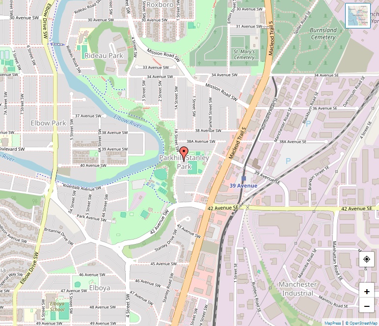
Strategically positioned in the southwest quadrant of Calgary, Alberta, Parkhill/Stanley Park is a captivating neighborhood that showcases a seamless blend of nature and modern city living. Lush greenery from the Elbow River and the iconic Stanley Park provide the backdrop to this historic community. Boundaries and Landscape Parkhill/Stanley Park is bordered by Mission Road to … Read more

Parkdale Map

Parkdale Map, Calgary

Situated along the scenic north bank of the Bow River, Parkdale is a mature, vibrant neighborhood in Calgary’s inner city. With a history dating back to 1948 and an advantageous location between West Hillhurst and Point McKay, this community seamlessly combines historic charm with contemporary living. Location Spanning a compact 0.6 km² (0.2 sq mi) … Read more

Panorama Hills Map

Panorama Hills Map, Calgary

Panorama Hills, a bustling suburban residential neighbourhood in Calgary’s northwest quadrant, is a testament to modern development and community planning. Established in 1994 by Ultima Development Corporation, the community spans across 6.3 km² (2.4 sq mi) and boasts a rich array of amenities, educational institutions, and recreational spaces. Historical Significance Panorama Hills is home to … Read more

Palliser Map

Palliser Map, Calgary

Palliser, a vibrant residential neighbourhood in Calgary’s southwest quadrant, embodies a rich history and a strong sense of community. Named after John Palliser, a prominent explorer and geographer of western Canada, the neighbourhood was established in 1967. It is strategically bounded by 90 Ave SW to the north, 19 Street SW to the east, Southland … Read more

Ogden Map

Ogden Map, Calgary

Located in the southeast quadrant of Calgary, Alberta, Ogden is a residential neighbourhood with a rich history and a vibrant community. The neighbourhood includes the districts of Lynnwood and Millican Estates, and it is bounded by Glenmore Trail to the south, Deerfoot Trail and the Bow River to the west, and the CPR tracks and … Read more

Oakridge Map

Oakridge Map, Calgary

Oakridge is a vibrant residential neighbourhood nestled in the southwest quadrant of Calgary, Alberta. It is bounded by 90 Avenue S to the north, 24 Street W to the east, and Southland Drive to the west and south, sharing a border with the Glenmore Reservoir and the Weaselhead Natural Area to the north. Established in … Read more

Nose Hill Park Map

Nose Hill Park Map, Calgary

Nose Hill Park, situated in the northwest quadrant of Calgary, Alberta, spans over 11 km² (4.2 sq mi), making it the fourth-largest urban park in Canada and one of the largest in North America. Established in the 1980s and operated by the City of Calgary, the park is open year-round, providing a natural retreat for … Read more

North Haven Map

North Haven Map, Calgary

North Haven, a residential neighbourhood nestled in the northwest quadrant of Calgary, Alberta, offers a unique living experience with its division into “Lower North Haven” and “Upper North Haven”. Established in 1963, the community has grown and developed, offering a peaceful and welcoming atmosphere to its residents. Location North Haven enjoys a strategic location, bordered … Read more

North Glenmore Map

North Glenmore Map, Calgary

North Glenmore Park is a residential neighbourhood located in the southwest quadrant of Calgary, Alberta. Positioned at 51°00′14″N 114°06′43″W, the area is celebrated for its picturesque setting and community-oriented atmosphere. Location The neighbourhood is bordered by 50 Avenue SW to the north, Glenmore Athletic Park, Lakeview Golf Course, and Earl Grey Golf Club to the … Read more

New Brighton Map

New Brighton Map, Calgary

New Brighton is a meticulously planned residential neighbourhood situated in the southeast quadrant of Calgary, Alberta, at coordinates 50°55′17″N 113°57′09″W. It stands out as a vibrant and inviting community, with a plethora of amenities and facilities to cater to the diverse needs of its residents. Location Nestled to the east of 52nd Street SE and … Read more